Category 5 Hurricane Melissa Approaches Jamaica
BBC News
This video can not be played
The world's most powerful storm this year is drawing closer to Jamaica as it moves northeast through the Caribbean Sea
Many Jamaicans have been evacuated – but the slow speed of Melissa's approach has made for an anxiety-ridden few days, our reporter in Jamaica writes
"There's this weird roar… like something's coming. The birds have all gone," says a British woman stuck on the island
The storm has already been blamed for three deaths in Jamaica, and four deaths in Haiti and the Dominican Republic
Forecasters believe it could become the strongest hurricane ever to hit Jamaica, with winds of 175mph (282km/h) and as much as 101cm (40 inches) of rain
Melissa was upgraded to a category five, which is the maximum strength, by the US-based National Hurricane Center early on Monday
What's making Melissa so dangerous? BBC Weather looks at three reasons
Edited by Sam Hancock and Ben Hatton, with reporting from Nick Davis in Jamaica and BBC Weather's Elizabeth Rizzini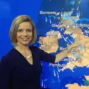 Sarah Keith-Lucas
Weather presenter
The link between human-induced climate change and hurricanes is complex.
Whilst climate change is not thought to increase the number of tropical storms or hurricanes, higher air and sea temperatures can make those that do form more intense, with stronger winds, heavier rainfall and a higher risk of coastal flooding.
The frequency of very intense hurricanes such as Melissa is increasing, and will continue to do so as our world warms.
In their latest assessment report, the International Panel on Climate Change (IPCC) concluded that "the proportion of Category 4–5 Tropical Cyclones will very likely increase globally with warming".
A study from World Weather Attribution looking at hurricane Milton last year found that climate change made the winds 10% stronger and the rainfall around 20-30% more intense.
Therefore, whilst the direct link between Hurricane Melissa and a warmer environment may be studied after the event, it is likely that it has been made wetter and windier by human-induced climate change.
As we've been reporting, Hurricane Melissa is predicted to be one of the most powerful on record to hit Jamaica. It was upgraded to a category five hurricane – the maximum strength – early on Monday by the US-based National Hurricane Center.
This short video clip with satellite video footage shows the storm intensifying since Sunday as it built from a category three to a category five hurricane:
This video can not be played
"This is a frightening situation for Jamaica," the country's Minister of Water, Environment and Climate Change tells the BBC World Service's Newsday programme.
Matthew Samuda says that 70% of the population lives within 5km (3.1 miles) of the sea. The storm will affect several low lying areas like Kingston, Old Harbour Bay, Rocky Point and St Elizabeth, he says.
"We hope we have done enough in terms of preparation," he says, adding that they've spent the last week telling people about shelters around the island and to place sand bags in their homes to guard against flooding.
Amid preparation for the hurricane, he says it has been a problem convincing people to go to shelters as they feel they must "protect their property as opposed to preserving their lives first".
Samuda implores for those in the diaspora to call family members "before it's too late". Elizabeth Rizzini
Lead weather presenter
This video can not be played
Watch: Storm chasers fly inside the eye of Hurricane Melissa
The eye of Melissa is still to the south of Jamaica. We say a hurricane makes landfall when the eye reaches the coast.
A hurricane, like other tropical cyclones, mainly consists of the outer rainbands, the eye and the eyewall.
Within the hurricane, air spins in an anti-clockwise direction in the northern hemisphere and then spills out of the top of the storm. So, in the very centre of the storm, air sinks.
The eye of the storm is relatively calm with light winds and, as you can see on satellite pictures, cloud free. Hurricane hunter planes fly into the eye to gather data on wind speed and atmospheric conditions.
The eyewall, rapidly ascending air, is around the air and helps to form the vacuum in the eye. It contains the strongest winds and consists of a ring of tall thunderstorms.
The lull in the eye of the hurricane can provide a false sense of security with the other part of the eyewall yet to come crashing through. Migrating birds can sometimes get trapped in the eye.
Sometimes in a hurricane, the eyewall can be replaced and this has been forecast with Melissa. When this happens, the storm weakens for a while as the inner eyewall collapses.
It can be replaced by another outer eyewall, which can allow the hurricane to re-intensify and become more stable and sometimes larger.
We've been hearing from more British tourists who are stuck in Jamaica.
Rebecca Chapman, in Jamaica for her 25th wedding anniversary, told BBC Radio 4’s Today programme she and her family arrived on Thursday evening – just as preparations for the storm began.
She's staying with her husband and three teenage sons in Lucea, about 30 minutes from Montego Bay, in a hotel that's spread across the coastline.
Their room is about 10m from the sea and the hotel is moving them to a different room that is more sheltered.
We’re in our rooms and have been told not go out; it doesn’t feel like it's here, but you know it’s coming."
Flying home before the hurricane “isn’t even an option; we’re stuck”, she says
"The weirdest part of all of it is whilst the sea is really rough and it was really windy, now it’s stopped," Rebecca says.
"There’s this weird roar that sounds like it’s coming from the sea. It’s really odd, like something’s coming. The birds have all gone so it’s all gone really quiet. It's like a ghost town." Sarah Keith-Lucas
Weather presenter
Although hurricanes are a recurring threat to Jamaica, it is likely that Hurricane Melissa could be the strongest storm on record to hit the island, causing catastrophic damage and bringing life-threatening storm conditions.
Due to its location in the warm tropical waters of the western Caribbean, tropical storms and hurricanes are an annual threat to Jamaica.
Hurricane season runs from June to November, and peaks in Jamaica in the second half of October.
Most years the island will feel the impacts of two or three tropical storms or hurricanes, but it is relatively rare for these storms to make a direct landfall.
Only three hurricanes have directly hit Jamaica since 1988.
If it is safe to do so, tell us how you have been affected by Hurricane Melissa
In some cases a selection of your comments and questions will be published, displaying your name and location as you provide it unless you state otherwise. Your contact details will never be published.
Alex Baskeyfield, from West Yorkshire, never expected to get caught in a hurricane during his trip to Jamaica with his wife and 13-year-old daughter.
It is incredibly daunting because the storm has intensified so quickly."
Alex, who is currently staying in the town of Negril on the west of the island, tried leaving Jamaica but airports have been closed and the few departing flights were fully booked.
He adds there are "extreme preparations" as windows have been shuttered with wood, everything has been tied down and ceiling fans and televisions have been taken off.
"There’s been an army of people for the last 48 hours unscrewing anything they could," he says.
"You do get a real sense that something incredibly serious is about to happen. It’s so strange and unusual for us."
This video can not be played
The BBC's Nick Davis has sent us this short video from the Jamaican capital, Kingston, where he says there are gusts and intermittent rain.
People on the ground are feeling strong gusts of wind and rain, but the full extent of the storm has not yet hit them.Elizabeth Rizzini
Lead weather presenter
A satellite view shows Tropical Storm Melissa over the Caribbean Sea
The eye wall is still to the south of Jamaica and much of the island is already under tropical storm conditions.
The storm is very slow moving at only 2mph (3.2km/h) in a north-easterly direction. Now that it has turned northwards, it could speed up a little.
The current sustained wind speeds are 175mph (282km/h) with higher gusts. It is an extremely dangerous category five hurricane. It's the strongest storm on Earth so far this year in terms of wind speeds and central pressure, which is currently just 901 millibars.
Landfall is expected later today in Jamaica and catastrophic and life-threatening hurricane-force winds are expected to begin this morning.
There will be another 15 to 30 inches of rainfall for Jamaica with a storm surge of up to 13ft near landfall on the south coast with large and destructive waves. On the north-west coast, near Montego Bay, there could be a 2ft to 4ft storm surge. We are expecting landslides and catastrophic flooding.
For Haiti, tropical storm conditions will begin later today too, with 6-12in of rainfall.
The storm will move northwards very slowly bringing further rain and will then make landfall again in south-eastern Cuba, still as a major hurricane.
Swells generated by Melissa are expected to affect portions of Hispaniola, Jamaica, eastern Cuba, and the Cayman Islands during the next several days, likely causing life-threatening surf and rip current conditions.
These swells will reach the Bahamas, the Turks and Caicos Islands, and Bermuda later this week. Sarah Keith-Lucas
Weather presenter
A man wearing a protective suit cycles on a street in Kingston overnight
Melissa is a particularly powerful, large and slow-moving hurricane, and there are several reasons why:
Warmer waters
Hurricanes need warm waters to provide their fuel, and higher heat on the sea surface has been injecting extra energy into the storm system. The waters in the western Caribbean are currently close to 30C, around two to three Celsius above average for the time of year.
Lack of wind shear
The winds in the atmosphere surrounding the hurricane are not changing very much with height, and this lack of wind shear has played an important role in allowing the hurricane's extensive growth.
When wind shear is greater, it tends to rip storms apart and allow them to weaken, but in this set up, Hurricane Melissa has been able to continue building and strengthening for several days.
Slow-moving
The 'steering winds' driving the hurricane forward are relatively weak.
This means that the storm system is moving forward slowly, at less than 4mph (6.4kmph), and so lingering over particular areas for a long time and continuing to produce torrential rainfall and destructive winds that would typically move through quicker with a faster-moving storm. Will Grant
Mexico, Central America and Cuba correspondent
Wave crash in Kingston's harbour view neighbourhood as Hurricane Melissa approaches Jamaica
For days, Jamaicans have waited and prepared for Hurricane Melissa’s arrival as satellite images have shown the vast storm strengthening and slowly bearing down on the island.
Now, the islanders are beginning to feel the full brunt of what is predicted to be the most powerful hurricane to hit Jamaica on record.
Sustained winds with speeds of up to 270kmph (168mph) have started to lash the Jamaican coast.
The fear is that as much as 102 centimetres of rain could be dumped on Jamaica within a matter of hours, leading to flash flooding, rivers bursting their banks and mudslides.
In the final hours ahead of the storm, the Jamaican government imposed a mandatory evacuation order on several areas including the coastal town of Port Royal.
Thousands of residents have taken refuge in government storm shelters but some have expressed reluctance to leave their homes.
Such is the ferocity of this slow-moving storm, more remote communities are in real danger of being completely cut off.
A fallen tree lies on a street in Kingston, Jamaica
The airport has been closed and international aid agencies like the UN World Food Programme are already co-ordinating with the Jamaican government – which says it has an emergency response budget of £25m ($33m).
Several people have been killed elsewhere in the Caribbean and at least three have already died in Jamaica during the storm’s approach.
While there is expected to widespread damage to infrastructure, the island’s authorities now just hope they have done enough – and that enough people have heeded the official warnings – to avoid any further loss of life. Nick Davis
Reporting from Jamaica
Many people have been evacuated from vulnerable areas in Kingston, ordered to do so by the government.
A Jamaican's house is more than their castle, and until the evacuation order was made, many preferred to ride out the storm at home.
But as another Instagram post stated: "I can't wait till we get back to precedented times" – with no more record storm surges, no more extensive island-wide flooding, and no hurricane speeds that make a hypercar blush.
In contrast, the slow speed of Melissa's approach has made for the most anxiety-ridden few days I've had in a while.
There are questions of will-it, won't-it make landfall; where will it turn; how long will I have internet; what's going to be left of my business?
The BBC's lead weather presenter Elizabeth Rizzini talks us through Hurricane Melissa's trajectory and strength in this one minute video:
This video can not be played
Watch: Hurricane Melissa strengthens as Jamaica braces for impactNick Davis
Reporting from Jamaica
A few days ago I joked with a former colleague that I was regretting my choice of living in an old Edwardian house here in Kingston, Jamaica.
The building was converted into flats decades ago and its old bones have seen their fair share of storms – but probably not one like this.
Outside my window is a century palm, a majestic 50-year-old tree taller than my building. My hope is that in the next few days it'll still be here.
Someone I follow on Instagram shared that he was driving around to take mental snapshots of the city, because the capital likely won't look the same for a while after this storm.
The BBC has journalists all over the world, but often they're "parachuted in" to gather the snippets and factoids to then transform into the record of events. Journalists say we should never "be the story", but this time my life and my family and friends are the top line, because Hurricane Melissa is a threat to our lives here.
I'd like to dedicate this first live page dispatch to my cousin Andrew, who works for the power company, away from his girls, to make sure the infrastructure we need is in place when we need it.
Meteorologist and storm chaser Matthew Cappucci tells the BBC that Melissa, a category five hurricane, will be the strongest to hit Jamaica since records began.
He talks about Hurricane Gilbert, which killed dozens of people in Jamaica in 1988, and he says it was a category three when it made landfall.
Melissa "could be an order of magnitude more significant", because hurricane strength doesn't go up linearly – it goes up exponentially.
"Nobody in Jamaica has lived through anything comparable to what they're going to get," Cappucci says.
He adds that while category five storms do occur, they tend not to reach land.
"It is extremely rare to get a category five with impact anywhere on Earth."
Jamaica’s prime minister, Andrew Holness, has ordered a mandatory evacuation of low lying areas as the island prepares for Hurricane Melissa to make landfall.
Shelter orders are also in place in the country, and all public schools have been moved online.
The two international airports, Norman Manley International Airport in Kingston and Sangster International Airport in Montego Bay, have also shuttered, suspending all operations over the weekend.
A man watches waves crash at the Kingston Waterfront as Hurricane Melissa approaches on 27 October
Hurricane Melissa will bring "catastrophic and life-threatening flash flooding" to Jamaica, says the National Hurricane Center., external
The US-based group expects between 15 and 30 inches of rainfall to hit Jamaica, with extensive rain in Cuba and the south-eastern Bahamas, bringing "numerous landslides".
As the hurricane hits Jamaica, destructive winds of up to 130 mph (209 km/h) are expected to cause power cuts and isolate communities.
Storm surges of up to 13 feet, external above ground level are also likely with smaller surges in south-east Cuba.
It's a similar story in Haiti, Dominican Republic and south-eastern Bahamas, with the hurricane centre warning of life-threatening flash flooding and landslides.
The Jamaican government has done everything it can to prepare for a storm "the likes of which we have never seen", the country's Information Minister, Dana Morris Dixon, told Shaun Ley on BBC's Newshour.
With up to 40 inches of rain possible in parts of the island nation, Dixon says those are "numbers we've never seen in Jamaica in terms of rainfall".
And on top of that, Dixon added, October is already the country's rainy month.
"The ground is already very saturated. And then to take that much rain means we're going to have flooding, extensive flooding and landslides in the mountainous areas."
She said the last hurricane to directly hit Jamaica was 37 years ago, and urged people to take this one seriously.
Jamaica has 881 active shelters, and all of them are free, she added.
Jamaica is bracing for the world's strongest storm this year – and possibly the strongest on record for the island nation – as US meteorologists warn of "catastrophic and life-threatening" conditions.
Hurricane Melissa, which is expected to make landfall early on Tuesday, has already been blamed for three "storm-related deaths" on the Caribbean island, as well as four deaths in Haiti and the Dominican Republic.
With wind speeds of up to 175mph (282km/h), Melissa is a category five storm – the maximum strength. And it's intensifying.
Experts warn the hurricane's slow pace may mean prolonged torrential rain in some areas, increasing the risk of deadly flooding and landslides.
Stay with us as we bring you live updates.
Copyright © 2025 BBC. The BBC is not responsible for the content of external sites. Read about our approach to external linking.